 AAP News

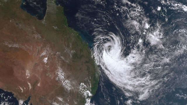
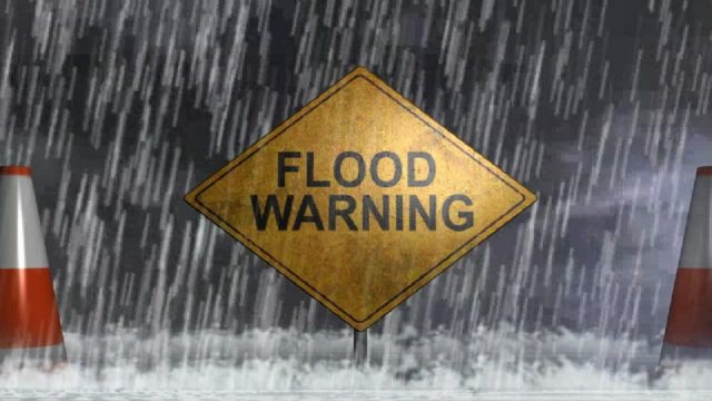
Coastal Queenslanders are on alert as Cyclone Alfred bears down, bringing high winds and tides. (Danny Casey/AAP PHOTOS)
Hundreds of thousands of people are on high alert as tropical cyclone Alfred heads towards Australia, putting coastal communities in the firing line.
Queensland Premier David Crisafulli has urged residents in the state’s southeast to do “everything they can”, like gather tinned food and supplies, before it makes landfall.
Alfred is expected to hit as a category two system on Thursday, however, the weather bureau says it’s hard to pinpoint exactly when or where it will cross the coast.
Communities from Bundaberg to the Gold Coast have been warned to expect intense winds, life-threatening flooding and very heavy rainfall.
“There is a real chance of … the cyclone crossing the coast in the southern part of the state,” Mr Crisafulli told reporters in Brisbane on Sunday.
“This is not a frequent occurrence and there may be Queenslanders who can be forgiven for thinking that this is something that doesn’t occur.
“Well, history shows that it does.
“That’s why we are taking that precautionary approach and asking people to do everything you can to get ready, things like making sure that you’ve got tinned food.”
A tropical cyclone warning will likely be issued in the coming days.
Residents are being told to pay attention to warnings, including evacuation orders.
Earlier on Sunday, the waves reached a record high of 14 metres in waters off Wide Bay, about 280km north of Brisbane.
Mr Crisifulli thanked campers in the region at K’gari, previously known as Fraser Island, who heeded evacuation warnings.
“Some coastal areas are potentially in the firing line and with the prospect of that severe wind warning, coupled with some pretty high tides, there is the real risk of further coastal erosion,” Mr Crisafulli said.
The cyclone was 370km northeast of Bundaberg on Sunday afternoon.
It’s expected to shift southeast before swinging west on Tuesday.
Bureau of Meteorology spokesman Matt Collopy said destructive winds, coastal inundation and heavy to intense rainfall were expected to be largely felt on the southern side of the cyclone.
“The heavy to intense rainfall is of particular concern – we may see multiple-day totals up to 300-600mm.
“This has the potential to cause life-threatening flash and riverine flooding from late Wednesday, but particularly through Thursday and Friday.”
“The riverine flooding will extend well beyond that, depending on exactly where the system moves.”

Stream the best of Fiji on VITI+. Anytime. Anywhere.